Last Updated: February 6, 2026
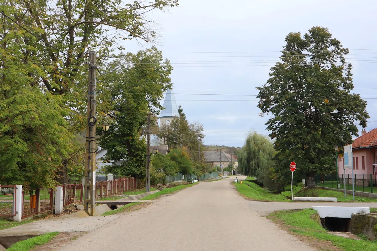
Tunney’s Pasture is Ottawa’s largest federal employment campus and one of the city’s most exciting redevelopment stories—a 49-hectare site transforming from a single-use government hub into a vibrant mixed-use neighbourhood with 7,000-9,000 new homes, direct O-Train access, and stunning Ottawa River views.
Located about 4 kilometres west of downtown Ottawa, Tunney’s Pasture has served as a federal government workplace since the 1950s and still accommodates around 12,000 employees across departments like Statistics Canada, Health Canada, and Library and Archives Canada. With the latest master plan amendments now approved, it’s also one of Ottawa’s biggest redevelopment projects.
The local community has been following developments closely. As one Ottawa resident shared: “Tunney’s is going to be unrecognizable in 10 years. Right now it’s mostly just government buildings and parking lots, but the redevelopment plan is massive. If you’re looking for long-term real estate investment, the surrounding neighbourhoods are worth watching.”
This guide breaks down what the area is today, how the O-Train hub works, what’s walkable nearby, and what to watch as the site changes over the next couple of decades.
Key Highlights
TL;DR: Tunney’s Pasture is a 49-hectare federal campus in Ottawa’s west end, home to 12,000+ government employees. O-Train Line 1 service provides direct downtown access (often about 10-20 minutes, depending on destination and wait time). Walking distance to Westboro Village for dining and shopping. Major redevelopment will add 7,000-9,000 residential units by 2050.
| Quick Facts | Details |
|---|---|
| 📍 Location | Ottawa West End, 4 km from downtown |
| 🏛️ Size | 49 hectares (121 acres) |
| 👥 Employees | ~12,000 federal workers |
| 🚇 Transit | O-Train Line 1 station (major west-end hub) |
| ⏱️ Downtown | About 10-20 minutes by O-Train |
| 🏠 Future Units | 7,000-9,000 residential (by 2050) |
What is Tunney’s Pasture?
 The 49-hectare federal campus features 19 government buildings
Tunney’s Pasture is a purpose-built federal government employment campus located in Ottawa’s west end. The 49-hectare site is bounded by the Ottawa River and Sir John A. Macdonald Parkway to the north, Scott Street to the south, Parkdale Avenue to the east, and the Champlain Park neighbourhood to the west.
The campus currently houses 19 federal buildings accommodating approximately 12,000 employees from major departments including Statistics Canada, Health Canada, Library and Archives Canada, and the Department of National Defence. While technically a single-use employment centre, the broader “Tunney’s Pasture neighbourhood” extends into surrounding communities like Westboro, Hintonburg, and Wellington West.
Name Origin
The area is named after Anthony Tunney, an Irish emigrant who arrived in Ottawa in 1867 and became the caretaker of a farmer’s pasture on this site. Though Tunney paid taxes on the land, he never formally claimed ownership. In 1947, the federal government expropriated the property for approximately $700,000 to develop as a government campus under the influential Gréber Plan.
The Gréber Plan, created by French urban planner Jacques Gréber, reshaped Ottawa’s development in the post-war era. Among its many recommendations was the decentralization of federal employment from the downtown core. Tunney’s Pasture became one of several suburban office campuses built to house the rapidly growing federal bureaucracy, joining sites like Confederation Heights to the south.
The campus’s development occurred in distinct phases. The first buildings rose in the early 1950s, followed by major expansion through the 1960s when brutalist architectural styles dominated government construction. The 1970s and 1980s added the taller office towers that now define the campus skyline. These later buildings, considered less architecturally significant, are slated for demolition under the current redevelopment plan while earlier heritage structures will be preserved.
The Federal Campus: Buildings and Employment
 Major federal departments have their headquarters at Tunney’s Pasture
Major Departments and Employers
Tunney’s Pasture serves as headquarters for several key federal departments:
| Department | Primary Buildings | Description |
|---|---|---|
| Statistics Canada | Jean Talon, R.H. Coats, Main Building | Canada’s national statistical agency |
| Health Canada | Brooke Claxton, Jeanne Mance, LCDC | Health policy and regulation |
| Library and Archives Canada | General Records Centre | National archives and records |
| National Defence | National Defence Data Centre | Defence data operations |
| Measurement Canada | Standards Building | Standards and certification |
Iconic Buildings
The Jean Talon Building (1979, 13 storeys) serves as Statistics Canada’s primary headquarters, featuring distinctive precast concrete-panel construction. The Brooke Claxton Building (1964) houses Health Canada and represents a key phase of campus development. Most heritage buildings from the 1950s-60s are designated for preservation, while newer 1970s-80s towers are planned for demolition under the redevelopment.
Campus Access
The campus functions as a secure federal facility with limited casual public access. However, the O-Train station is fully public, and surrounding streets and parks are accessible to everyone.
Tunney’s Pasture O-Train Station
 Tunney’s Pasture station is a major west-end hub on O-Train Line 1
Station Overview
Tunney’s Pasture station is a major station on Ottawa’s Confederation Line (O-Train Line 1), a fully grade-separated electric light rail system. The station opened in 2019 after conversion from the original 1983 transitway infrastructure.
Key Station Details:
- Location: Scott Street at Holland Avenue
- Design: Below-grade trench with side platforms
- Art Installation: “Gradient Space” by Derek Root featuring coloured mosaics and stained-glass skylight
- Accessibility: Fully accessible with elevators
Travel Times from Tunney’s Pasture
| Destination | Time | Notes |
|---|---|---|
| Parliament / Lyon area | ~10-15 min | Via O-Train |
| Rideau Centre | ~15-20 min | Via O-Train |
| ByWard Market | ~20-25 min | O-Train + short walk |
| Blair Station | ~35-40 min | Longer Line 1 trip eastbound |
| Hurdman Station | ~20-25 min | Via O-Train (for east/south transfers) |
Service Frequency: Trains typically run every few minutes during busier periods and less frequently off-peak. Check real-time OC Transpo updates before travelling.
Bus Connections
The station’s transitway loop accommodates multiple OC Transpo routes providing connections to Barrhaven, Kanata, south Ottawa, and surrounding neighbourhoods. Service patterns continue to shift as O-Train expansion and bus-network changes roll out. Always confirm current routing and transfer points in OC Transpo trip planning tools.
What Transit Users Say
“I used to take the bus to Westboro, but since moving closer to Tunney’s and taking the LRT, my commute is so much better. It’s reliable—I no longer need to check arrival times like I did with buses.” — r/ottawa user
The 2025 Master Plan: Transforming Tunney’s Pasture
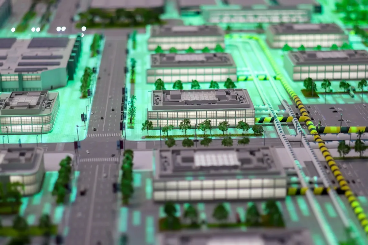 The Master Plan envisions a vibrant mixed-use neighbourhood
A Bold New Vision
The 2025 Tunney’s Pasture Master Plan represents a dramatic transformation from single-use employment campus to a complete, mixed-use neighbourhood. Approved by the National Capital Commission in January 2025, the plan will reshape this 49-hectare site over the next 25 years.
Key Development Components
| Feature | Details |
|---|---|
| Residential Units | 7,000-9,000 new homes |
| Affordable Housing | Minimum 20% of units |
| Office Space | 94,000 m² (reduced from original plan) |
| Commercial Space | 8,000 m² retail/services |
| Public Greenspace | 24 hectares (~50% of site) |
| Building Heights | 3-4 storeys at edges, up to 40 storeys near transit |
Development Timeline
Canada Lands Company (CLC) was designated as the redevelopment partner in January 2025. Land parcels are being transferred in phases:
- 2025: Parcels 1-4, 9-10
- 2026: Parcels 6 and 8
- 2032: Parcel 7 (Brooke Claxton Building)
A Draft Plan of Subdivision was submitted to the City in September 2025. Phase 1 development (2027-2035) will add 2,000-3,000 units, with full build-out extending to 2050.
Community Perspectives
Reddit users have mixed reactions to the plans. Supporters celebrate the housing opportunity: “7,000 to 9,000 residential units, at least 20% designated as affordable housing… this seems like a solid plan.” Others express concerns about parking elimination and office displacement. Federal employees worry about reduced parking: “Looks like we’re losing all our office parking—that’s going to be challenging.”
Planning enthusiasts see the potential: “This is exactly the kind of transit-oriented development Ottawa needs. You have an O-Train terminus right there—it’s the perfect place for density. The pathway connections to the river are already excellent.”
However, skeptics question the timeline: “These government redevelopment projects always take longer than promised. They’re saying 2050 for full build-out, but I wouldn’t be surprised if it takes even longer. Still, at least the planning is finally happening.”
Environmental and Sustainability Goals
The Master Plan incorporates significant environmental commitments that align with modern urban development standards:
Green Space Preservation: Approximately 24 hectares—nearly half the site—will remain as public greenspace. This includes maintaining and enhancing connections to the Ottawa River shoreline and the existing pathway network.
Energy Efficiency: New buildings will be designed to meet current energy standards, with provisions for net-zero construction in later phases. The density near the O-Train station specifically aims to reduce car dependency.
Stormwater Management: Modern stormwater infrastructure will replace aging systems, incorporating permeable surfaces and bioswales to manage runoff and reduce impact on the Ottawa River.
Tree Canopy: While some trees will be removed during construction, the plan calls for substantial new planting to maintain and eventually exceed current canopy coverage.
Nearby Attractions and Neighbourhoods
Westboro Village (0.5-1.5 km)
Westboro is Ottawa’s most upscale west-end neighbourhood, renowned for independent boutiques, high-end dining, and excellent walkability. Just a short walk from Tunney’s Pasture, Westboro offers:
Dining Highlights:
- Fine Dining: Fusion, Caffe Mio
- Casual: Pho Viet Taste, Markie’s Smoked Meats, Shawarma Al Mouna
- Coffee: Happy Goat Coffee, Quelque Chose Patisserie
- Breweries: Tooth & Nail, Kichesippi Beer
Shopping:
- MEC (outdoor gear)
- Independent boutiques and art galleries
- Farm Boy grocery
- Richmond Road shopping corridor
Westboro Beach (1.2 km)
Reopened in summer 2025 with major renovations, Westboro Beach is a sandy public beach on the Ottawa River featuring:
- Free admission with lifeguards (June 21-August 24, noon-7 PM)
- Beach café serving coffee, ice cream, and açaí bowls (9 AM-11 PM)
- Activities: Volleyball, paddleboarding, kayaking
- Amenities: Accessible washrooms, solar-heated showers
Ottawa River Pathway
The Ottawa River pathway system provides 40+ kilometres of scenic routes for cycling, walking, and running. The multi-use pathway runs directly past Tunney’s Pasture, connecting to downtown Ottawa and westward to Gatineau. Check out our hiking trails Ottawa guide for more route details.
Parkdale Market (1.2 km south)
Ottawa’s second-oldest farmers market operates at 366 Parkdale Avenue. Features include:
- Local produce and artisan goods
- Parkdale Night Market: Wednesdays, 5-9 PM (June-Thanksgiving)
- Community events and live entertainment
Champlain Park (0.5 km west)
This NCC-managed natural area features biodiversity gardens, pollinator gardens, and a “Miyawaki” tiny forest of 130 densely planted native trees. Free and open to the public for walking, bird-watching, and nature education.
Living Near Tunney’s Pasture
 The surrounding neighbourhoods offer diverse housing options
Current Housing Market (2025)
While the Tunney’s Pasture campus itself has limited residential options currently, the adjacent neighbourhoods—Westboro, Hintonburg, and Wellington West—offer established residential character.
| Housing Type | Price Range | Notes |
|---|---|---|
| Single-Family Homes | $600K-$1.2M+ | Pre-1960 heritage homes, gentrifying |
| Condos/Townhouses | $450K-$800K | Modern infill, new construction |
| Apartments (Rent) | $1,400-$2,400/month | Purpose-built and converted |
| Room Rentals | $1,000-$1,400/month | Shared housing, all-inclusive |
Pros of Living Near Tunney’s Pasture
- Exceptional Transit: O-Train access with a quick downtown trip (typically about 10-20 minutes)
- Walkability: Hintonburg/Westboro score 75-85 on Walk Score
- Recreation: Ottawa River pathway, Westboro Beach, and cycling trails
- Dining Scene: Independent restaurants, craft breweries
- Future Growth: Major redevelopment will add density and amenities
- Relative Value: $200-400K cheaper than downtown/Glebe
Cons to Consider
- Traffic: Wellington/Richmond streets can be congested
- Parking: Being reduced; street parking inconsistent
- Winter: Harsh climate requiring good snow management
- Commercial Gaps: Limited grocery directly in Hintonburg
- Campus Character: Currently quiet evenings on campus
Dining and Services
Restaurants Near Tunney’s Pasture
The nearby Westboro and Wellington West areas offer excellent dining options:
| Cuisine | Recommended |
|---|---|
| Fine Dining | Fusion, Caffe Mio |
| Vietnamese | Pho Viet Taste |
| BBQ | Markie’s Smoked Meats |
| Middle Eastern | Shawarma Al Mouna |
| French | Mantus (brunch, oysters) |
| Italian | Fratelli (family-run, 30+ years) |
| Sushi | Sapporo Sushi |
| Vegetarian | Pure Kitchen |
For more dining ideas, explore our guides to best brunch in Ottawa and best patios in Ottawa.
Grocery and Shopping
| Type | Location | Distance |
|---|---|---|
| Metro | 345 Carleton Ave | 10-15 min walk |
| Farm Boy | Westboro | 15 min walk |
| Hintonburg Market | 1059 Wellington St W | Specialty meats, produce |
| Giant Tiger | 1085 Wellington St W | Budget options |
| Parkdale Market | 366 Parkdale Ave | Seasonal farmers market |
Essential Services
- Pharmacies: Wellington Drug Store, Shoppers Drug Mart
- Banks: Royal Bank, TD, CIBC on Wellington St W
- Gyms: Various options in Hintonburg/Westboro
- Community Centre: Hintonburg Community Centre (1064 Wellington St W)
Cycling and Outdoor Activities
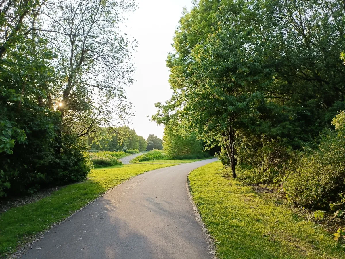 The Ottawa River pathway offers scenic cycling year-round
Cycling Infrastructure
Tunney’s Pasture sits at a key junction in Ottawa’s cycling network. The multi-use pathway (MUP) system provides traffic-free connections:
- Ottawa River Pathway: 40+ km of scenic routes to downtown and Rockcliffe
- Sir John A. Macdonald Parkway Path: Separated cycling north of the campus
- Chief William Commanda Bridge: Connection to Gatineau
Local cyclists recommend: “From Vanier, I cycle to Tunney’s avoiding downtown whenever possible. The Ottawa River pathway is beautiful and mostly traffic-free.”
Winter Activities
Ottawa’s winter trail network near Tunney’s Pasture includes:
| Trail | Distance | Notes |
|---|---|---|
| Kichi Sibi Winter Trail | 5+ km | Runs past Tunney’s Pasture |
| Britannia Winter Trail | 17 km | Between Deschênes and Andrew Haydon Park |
| Ottawa West Winter Trail | 21 km | Moodie to Carling, free |
| Gatineau Park | 200+ km | 20 min drive, day pass required |
For winter festival fun, check out our Winterlude Ottawa guide.
A Day in the Tunney’s Pasture Area
For visitors or prospective residents exploring the area, here’s how to experience the best of Tunney’s Pasture and its surrounding neighbourhoods.
Morning
Start at the Tunney’s Pasture O-Train station and head north toward the Ottawa River. The pathway system here is exceptional—wide, well-maintained, and offering beautiful river views. Walk or cycle west toward Westboro Beach, about 15-20 minutes on foot.
If visiting in summer, arrive early at Westboro Beach before the crowds. The beach café opens at 9 AM with excellent coffee. Alternatively, continue along the pathway toward Britannia for a longer exploration.
Midday
Head south toward Westboro Village on Richmond Road. The neighbourhood offers excellent brunch options—check out Quelque Chose Patisserie for French pastries or find a patio seat at one of the many cafés.
After eating, explore Westboro’s independent shops. MEC for outdoor gear, various boutiques for clothing and home goods, and the general atmosphere of Ottawa’s most walkable commercial district.
Afternoon
Walk east along Wellington Street toward Hintonburg for a different neighbourhood character—more artsy, slightly grittier, but equally interesting. Stop at Parkdale Market if it’s the right season.
Return to Tunney’s Pasture station via Scott Street, observing the campus buildings and imagining the transformation the Master Plan will bring over the coming decades.
Evening
The Wellington West dining scene offers excellent dinner options. Reserve ahead for popular spots like Fusion or explore the diverse casual options along the strip.
Practical Tips
For Commuters
- Best Transit Times: Avoid 8-9 AM and 4:30-6 PM weekday peaks
- O-Train Reliability: Generally reliable; minor delays during heavy snow
- Parking: Limited and being reduced—prioritize transit or cycling
- Bike Storage: Campus provides bike racks; secure storage recommended
For Federal Employees
- Hybrid Work: Confirm your department’s in-office requirements (often 3+ days/week)
- Parking Strategy: Consider Park and Ride at Fallowfield or Baseline stations
- Lunch Options: Campus cafeterias available; limited external options currently
- Relocation Tip: “A 1-hour commute equals 2 hours daily—3+ weeks lost annually. Living closer pays off.”
Weather Considerations
| Season | Conditions |
|---|---|
| Summer | 25-30°C, perfect for beach and cycling |
| Winter | -15 to -25°C, dress in layers |
| Spring/Fall | Variable, 5-15°C |
FAQ
Q: What is Tunney’s Pasture in Ottawa?
Tunney’s Pasture is a 49-hectare federal government employment campus located in Ottawa’s west end, approximately 4 kilometres from downtown. The site currently houses 19 government buildings and accommodates around 12,000 federal employees from departments including Statistics Canada, Health Canada, and Library and Archives Canada.
Q: How do I get to Tunney’s Pasture by transit?
Tunney’s Pasture station is a major stop on O-Train Line 1 (Confederation Line). From downtown Ottawa, take Line 1 westbound; trips to Tunney’s are typically short and often around 10-20 minutes depending on your starting station and wait time. Multiple OC Transpo bus routes also connect to the station’s transit loop. Regular fare is $3.75 or use a Presto card.
Q: What is happening with the Tunney’s Pasture redevelopment?
The 2025 Master Plan will transform Tunney’s Pasture from a single-use employment campus into a mixed-use neighbourhood with 7,000-9,000 residential units, 94,000 m² of office space, and 8,000 m² of commercial space. At least 20% of housing will be affordable. Development will occur in phases through 2050.
Q: What departments are located at Tunney’s Pasture?
Major federal departments at Tunney’s Pasture include Statistics Canada (largest tenant), Health Canada, Library and Archives Canada, Department of National Defence, and Measurement Canada/Industry Canada. The campus accommodates approximately 12,000 federal employees.
Q: Is there parking at Tunney’s Pasture?
Currently, surface parking exists on campus but is being systematically reduced under the redevelopment plan. Federal employees may have access to limited parking, but transit via the O-Train is strongly recommended. The area has minimal street parking in surrounding neighbourhoods.
Q: What is there to do near Tunney’s Pasture?
Tunney’s Pasture is walking distance from Westboro Village (shops, restaurants), Westboro Beach (swimming, paddleboarding), Parkdale Market (farmers market), and the Ottawa River pathway (40+ km of cycling/walking trails). Champlain Park offers nature walks and bird watching.
Q: How far is Tunney’s Pasture from downtown Ottawa?
Tunney’s Pasture is approximately 4 kilometres west of downtown Ottawa. By O-Train Line 1, the journey to the downtown core is typically around 10-20 minutes (destination-dependent). By car or bicycle, expect 10-15 minutes depending on traffic and route.
Q: Can the public access Tunney’s Pasture campus?
The campus functions primarily as a secure federal facility with limited casual public access. However, the O-Train station is fully public, and surrounding streets, parks (Champlain Park), and pathways are accessible to everyone.
Q: What is the history of Tunney’s Pasture?
The area is named after Anthony Tunney, an Irish emigrant who arrived in 1867 and became caretaker of the land. In 1947, the federal government expropriated the property. Development as a federal campus began in the 1950s under the Gréber Plan, with most original buildings constructed through the 1960s.
Q: Is Tunney’s Pasture a good place to live?
The immediate campus has limited residential options currently, but adjacent neighbourhoods (Westboro, Hintonburg, Wellington West) are highly desirable. Pros include excellent transit access, walkability, Ottawa River recreation, and a vibrant dining scene. The upcoming redevelopment will add 7,000-9,000 new housing units directly on the campus.
Final Thoughts
Tunney’s Pasture represents one of Ottawa’s most compelling urban stories—a mid-century federal campus poised for transformation into a complete, transit-oriented neighbourhood. Whether you’re a federal employee commuting to work, a prospective resident exploring housing options, or a visitor discovering Ottawa’s west end, Tunney’s Pasture offers excellent transit connectivity, stunning river access, and proximity to the vibrant Westboro and Wellington West communities.
The 2025 Master Plan promises exciting changes ahead: thousands of new homes, expanded public spaces, and a more dynamic urban environment. For now, strong O-Train access makes this one of Ottawa’s most accessible destinations, with quick trips from downtown and direct access to the Ottawa River pathway network.
Sources: Canada.ca Tunney’s Pasture Redevelopment, Canada Lands Company, OC Transpo, r/ottawa